Getting Earth Observations “Out There”
By Prof. Chris Merchant…
The Earth Observation Climate Information Service dedicates the majority of its resources to creating observations of our changing global environments for the purposes of scientific understanding. Funded via the Natural Environment Research Council, having science at the core of our mission is right and proper.
But EOCIS has “Service” in its name, and the project also has an aim to foster wider application of the precious and sometimes unique information we create about our climate and environment.
A key means for this aim is through “Actionable Information Projects” (AIPs). A clunky name, but a descriptive one. These are projects where DATA are turned into INFORMATION that can be practically ACTED on by third parties beyond our core science consortium.
We are pleased to be able to announce the four AIPs for 2024-2025. In no particular order:
CarbonGauge
This AIP is a collaboration between Space Clipper Industries, the James Hutton Institute, University College London and University of Southampton.

The purpose is to strengthen the Woodland Code that verifies the carbon captured from the atmosphere in UK tree-growing schemes for climate change mitigation. Cost-effectively assessing how much carbon has been sequestered is a challenge, and in this project the role(s) of various forms of Earth Observation in aspects of that challenge will be developed and – if all goes well – embedded into good practice for the sector.
SISEM: Satellite Imagery for Solar Energy Monitoring
Optimising the operations of solar energy electricity-generation “farms” is in part an exercise in information mining. The energy output of every solar panel relative to the energy in the sunlight which the weather provides is key information for managing the operation. In SISEM, satellite-based information on the surface solar irradiance will be trialled as a real-time information source to the management system for ~18000 solar installations around the UK.
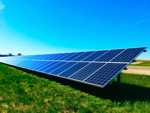
This project is a collaboration of AMIRA Technologies, Ecovision Asset Management and the Rutherford Appleton Laboratory Space division (RAL Space).
Wildfire Risk in Europe under Future Climate Scenarios (WREFS)
This project is being undertaken by Telespazio UK supported by King’s College London.
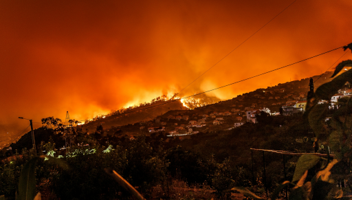
KCL’s multi-year archives of wildfires detected from space by Earth observation will be used to tune calculations of Fire Weather Index for the recent past, to enable projections of the future of wildfire risk under climate change scenarios encapsulated in climate model outputs.
Early Warning of Agricultural Drought in Kenya
Kenya is prone to drought, resulting in crop failures and sustained food insecurity. Under EOCIS, continental scale monitoring of root-zone soil moisture has been pioneered based on rainfall observations and land-surface modelling. This is exactly what is needed to raise early alerts for drought conditions to trigger interventions: while observations on the ground are immensely valuable, the country-wide picture from satellite-driven modelling gives highly complementary information across the in situ monitoring gaps.
This project is a collaboration of the Kenya Meteorological Department and University of Reading.
For updates on progress…
All four AIPs will run until February 2025. Check back here for updates. Each involves NCEO university partners joining non-academic businesses or agencies to create new information of practical use, based on a satellite’s-eye view of our precious planet Earth.