Mapping Wildfires in Near Real-Time: High-resolution satellite imagery meets AI for smarter wildfire response
By Prof Kevin Tansey and Dr Akram Abdulla (University of Leicester)
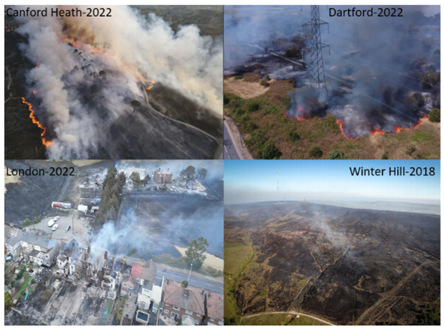
Wildfires are increasingly becoming a major environmental concern across the globe. Even in the UK -where fires are generally small and short-lived – they can cause significant ecological and public health damage. For example, the summer of 2022 witnessed widespread wildfires across the country due to an exceptional rise in temperatures, exceeding 40°C in many parts of the UK. These events starkly illustrate the growing sensitivity of British landscapes to climate change and extreme weather conditions. They also highlight the urgent need for improved preparedness, real-time monitoring, and early-warning systems to help mitigate the escalating risks of such climate-driven disasters.
To improve how we detect, monitor, and respond to these events, we’re developing a near-real-time wildfire mapping system as part of the Earth Observation Climate Information System (EOCIS), in collaboration with the National Centre for Earth Observation (NCEO).
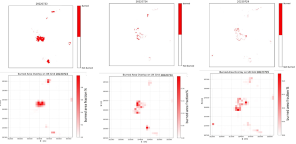
The UK’s wildfire events are often spatially confined and short-lived, lasting just a few days. This presents unique challenges for traditional satellite monitoring systems like MODIS or Sentinel-2, which either lack the spatial detail or have long revisit times. To overcome this, our system uses PlanetScope imagery, which offers 3-metre resolution and captures images up to four times per day, making it ideal for detecting rapidly evolving fires in smaller landscapes, including urban, grasslands, shrubland, woodland and mixed
This high-frequency imagery is paired with an adaptive machine learning classification model tailored specifically for UK land cover types.
At the heart of the system is a multi-stage processing pipeline. It begins with searching for wildfires using trusted external sources. An example has been NASA’s FIRMS, and in future it could be based on the rapid fire detection capability developed under EOCIS. Once a wildfire is detected, relevant pre- and post-Planet imagery is retrieved using API service and passed through the training processing stage using random forest algorithm.
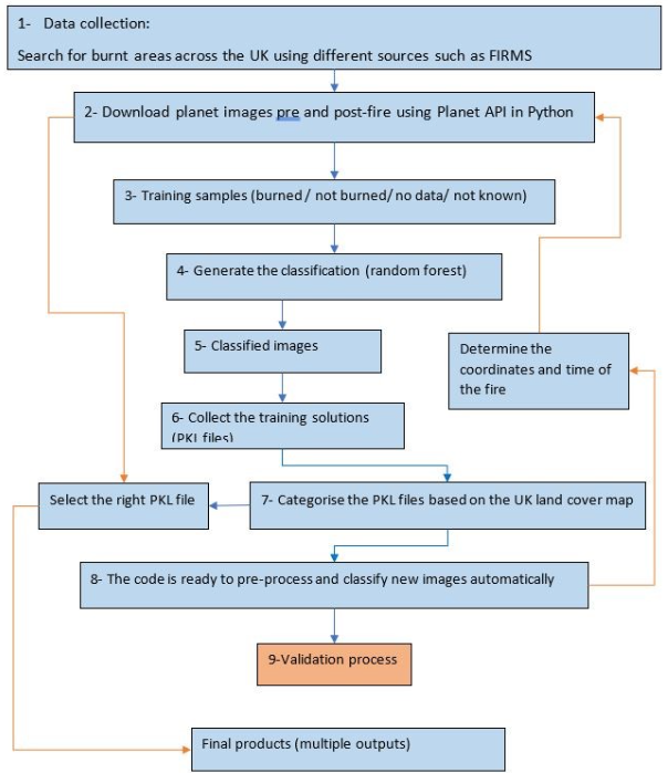
The key element of our methodology is this tailored pre-processing pipeline, which generates custom training datasets from pre-fire and post-fire imagery across diverse land cover types. This tailored training process is essential for accurate burned-area classification, ensuring that the model adapts to variations in land cover, local environmental conditions, and spectral signatures. This enables high-precision mapping even in complex and heterogeneous landscapes across the country.
The system is designed to produce multiple output types, each targeting specific user needs:
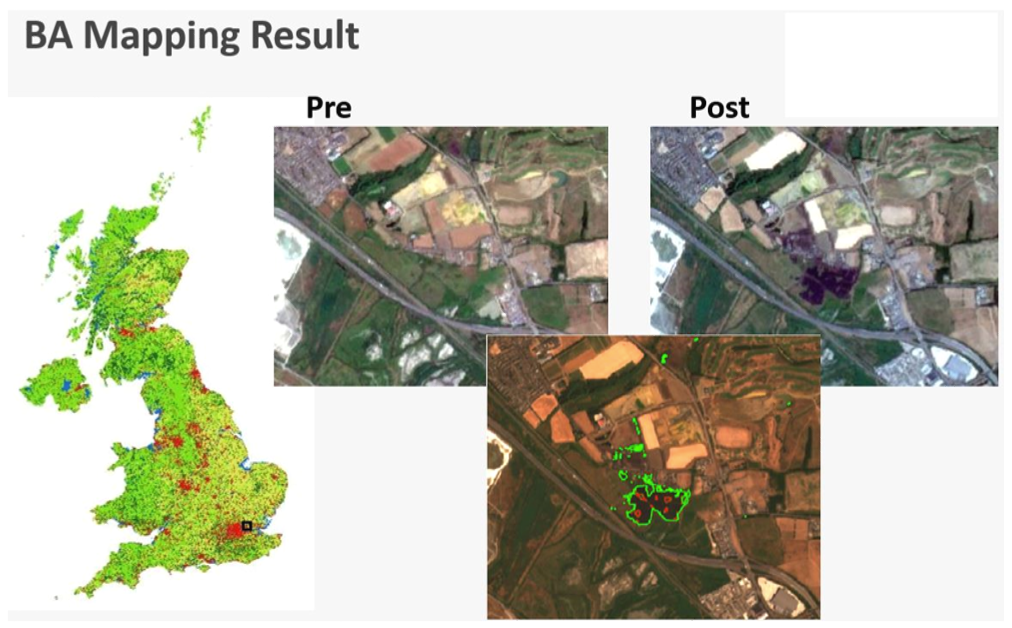
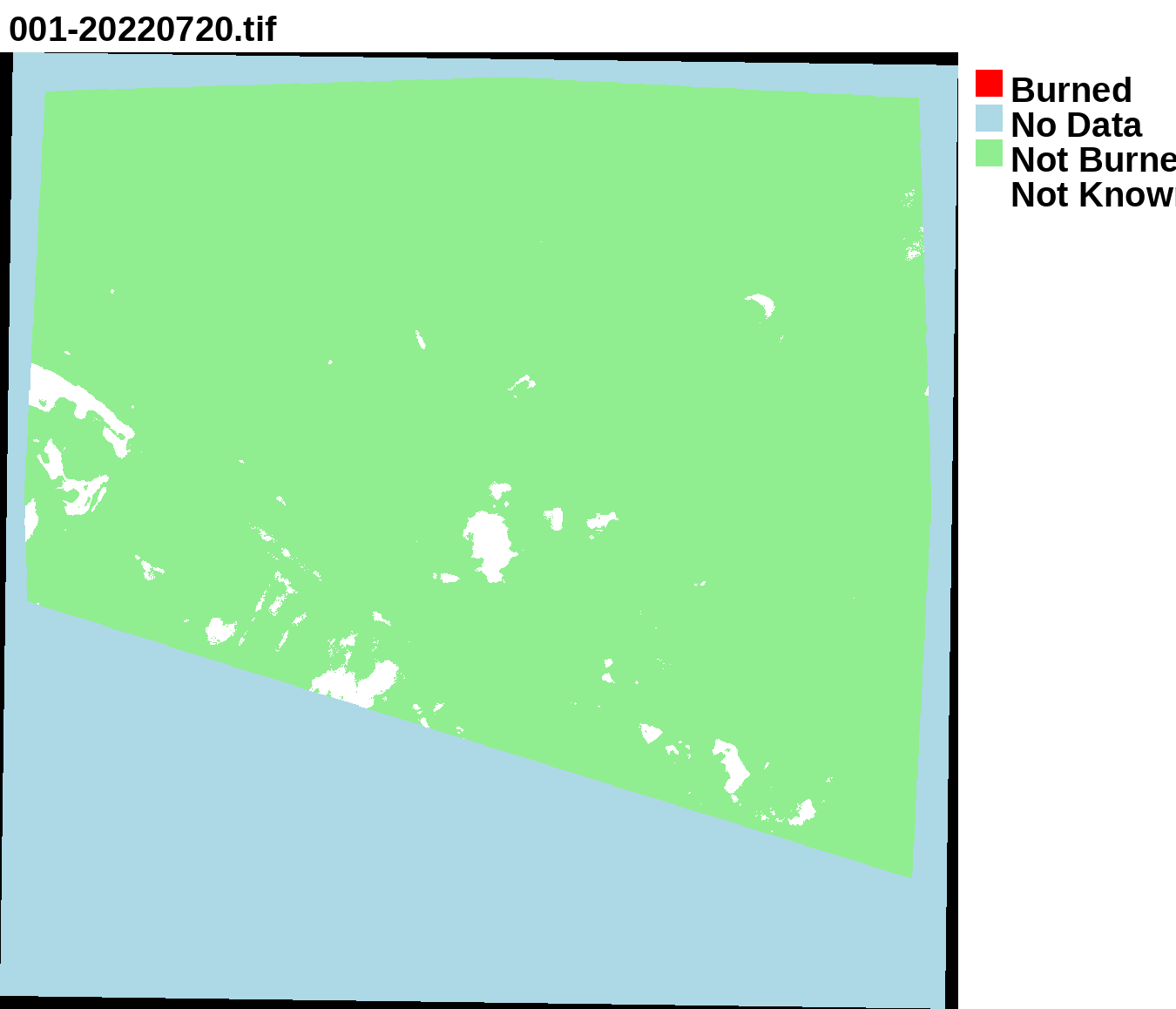
- Pixel-level burned area classification from each post-fire image at 3m resolution
- Fire dynamics animations showing how the burned area evolves daily
- Smart filtering to automatically skip dates when no new fire spread is detected
- Downscaled outputs in NetCDF format at 100 m resolution for broader-scale integration and climate applications
This flexibility allows both real-time tracking and historical assessments, helping users to visualise fire patterns and assess ecological impacts over time.
The system runs on a cloud-based infrastructure, making it accessible 24/7 to a wide range of stakeholders—from local land managers and firefighters to national-level conservation organisations. Users can upload their areas of interest to retrieve archived burned-area maps, track ongoing fires, and download formatted outputs for further analysis.
By integrating high-resolution satellite observations with smart, adaptive AI models, this system brings a new level of detail and timeliness to wildfire monitoring in the UK. As fire risks increase in response to climate change, tools like this will be essential in protecting our landscapes, ecosystems, and communities.
This project demonstrates how Earth observation science, artificial intelligence, and environmental research can come together to drive innovation, inform policy, and support resilience in the face of climate extremes.
For more information, please contact Prof. Kevin Tansey (kjt7@leicester.ac.uk).