The UK Earth Observation Climate Information Service exploits the observations available from environmental sensors orbiting in space to create climate data records and climate information.
Find out more >>

Learn about EOCIS >>
Latest Posts:
- Predicting Future Wildfire Intensity: A New Approach to Understanding Future Wildfire Risk
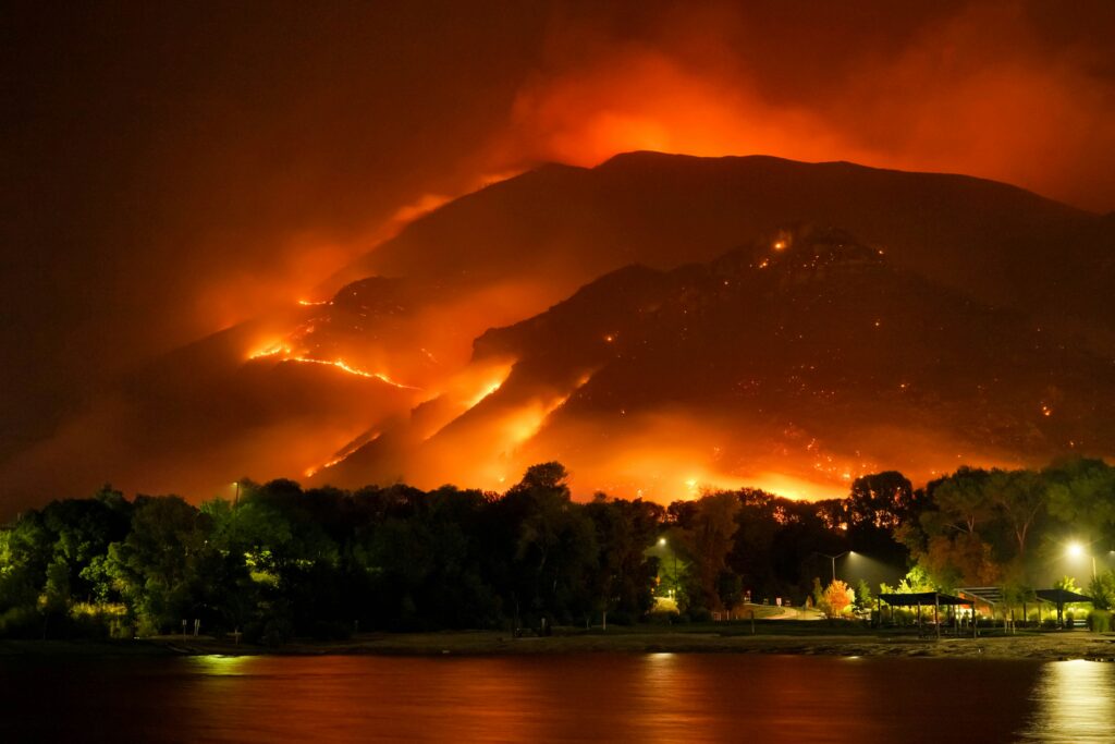 Predicting Future Wildfire Intensity: A New Approach to Understanding Future Wildfire Risk By Telespazio UK… As wildfires become increasingly frequent and severe across Europe, the insurance industry and emergency planners face a critical challenge: how do we move beyond simply knowing where fires might occur, to how intense could they be? The Problem Traditional wildfire risk assessment relies heavily on the Fire Weather Index (FWI) – a well-established metric that tells us about optimal … Read more
 - Mapping Wildfires in Near Real-Time: High-resolution satellite imagery meets AI for smarter wildfire response
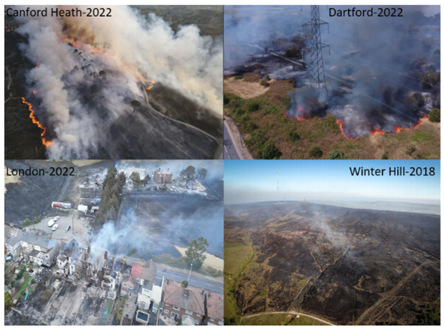 Mapping Wildfires in Near Real-Time: High-resolution satellite imagery meets AI for smarter wildfire response By Prof Kevin Tansey and Dr Akram Abdulla (University of Leicester) Wildfires are increasingly becoming a major environmental concern across the globe. Even in the UK -where fires are generally small and short-lived – they can cause significant ecological and public health damage. For example, the summer of 2022 witnessed widespread wildfires across the country due to an exceptional rise … Read more
 - Long-term Global Mapping of Atmospheric Aerosols from Space
 Long-term Global Mapping of Atmospheric Aerosols from Space by Dr. Kevin Pearson, Swansea University… When we hear the word “aerosol” we normally think of something like a can of spray paint or perhaps a scent bottle. Rather than the containers, however, “aerosol” really describes the fine spray of particles or droplets that these dispense and that remain suspended in the air. Suspended aerosols can be injected into the stratosphere as high as 25 km … Read more
 - Understanding the global atmospheric methane surge: insights from satellites
 Understanding the global atmospheric methane surge: insights from satellites By Lakshmi Bharathan, Theo Morgan Lundie, Robert Parker and Paul Palmer … Over the past decade, atmospheric methane has steadily increased, reaching record-breaking values in 2020 and 2021. The reasons for this rapid increase in atmospheric methane is still puzzling scientists, with potentially profound implications for understanding future climate. Without better knowledge we cannot determine how it will impact the effectiveness of the Global Methane Pledge. … Read more
 - EOCIS Meeting at Henley Business School
 EOCIS Meeting at Henley Business School – February 17th – 19th 2025 EOCIS scientists are meeting in the elegant surroundings of Henley Business School for the final project meeting and to plan future work.
 - Applications of the EOCIS Land Ice and Sea Ice Datasets
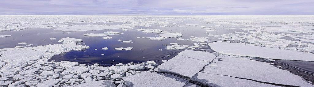
 Applications of the EOCIS Land Ice and Sea Ice Datasets By Jennifer Maddalena, Amy Swiggs, Nicola Bortun, and Kate Briggs… The Frozen Frontiers The polar regions are often referred to as Earth’s frontiers of climate change. The ice that blankets these regions is dynamic, constantly growing, shrinking, melting and moving in response to natural cycles and human-influenced climate changes. From impacting the weather we experience, to supporting unique ecosystems and contributing to global sea … Read more
 - Lakes are experiencing increasingly frequent multivariate extremes
 Lakes are experiencing increasingly frequent multivariate extremes By Dr. R. Iestyn Woolway and Dr. Haoran Shi Lakes hold 87% of Earth’s liquid surface freshwater and are key water sources for human society. However, due to both anthropogenic and climatic impacts, lakes are experiencing increasingly frequent extreme events (e.g., heatwaves, algal blooms and anomalously low water levels), which have various negative influences on lacustrine ecosystems. Thanks to the rapid development of satellite technology and Earth … Read more